Projects
A GeoLibre project captures your whole workspace in a single .geolibre.json file: the map view, the basemap, every layer with its source and style, map preferences, plugin state, and environment variables. Everything in this section lives under the Project menu.
Some entries may be hidden
The Project menu is filtered by the active UI profile, and a few entries are desktop-only. If an item described below is missing, check the profile in use and whether you are running the browser build.
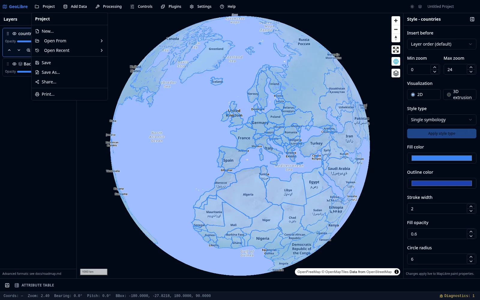
New
Project → New... starts a fresh project. GeoLibre offers to save the current project first, then resets the layers, map view, controls, and plugin state to defaults.
Open
Project → Open From has two sources:
- File... opens a
.geolibre.jsonfile from disk (desktop app). - URL... loads a public
.geolibre.jsonfrom an HTTP or HTTPS URL. This works in the browser too and adds the project to your recent list. - Gallery... browses the shared project gallery and opens any entry with one click.
Project → Open Recent lists the projects you have opened before, each with its name, path, and the time you last opened it. Click an entry to reopen it, use the small remove button to drop a single entry, or choose Clear Recent Projects to empty the list. On the desktop app the recent list persists across sessions; in the browser it tracks URL-based projects.
Loading a project at startup
You can open a project directly by passing its URL with the url query parameter, for example ?url=https://share.geolibre.app/you/project.geolibre.json. See Embedding & Sharing.
Save and Save As
- Save writes back to the project's existing file path.
- Save As... prompts for a new name and location.
Both capture the current map view, basemap, layers, styles, preferences, and plugin state at the moment you save. Projects that were opened from a URL have no writable local path, so both Save and Save As fall back to the save dialog. Saving requires the desktop app.
Project → Duplicate project copies the open project into a new, unsaved one, so you can branch off an experiment without touching the original file.
Project history and crash recovery
GeoLibre autosaves the project as you work. Three seconds after a change settles — a layer added, a style edited, the camera moved — it writes a snapshot to your browser's local IndexedDB storage. Autosaves never touch your .geolibre.json file; only Save does that.
Project → History... lists the snapshots for the current project, newest first, each summarized by its layer count and zoom level. Restore loads a snapshot back into the workspace, as an undoable step so you can back out of it. There is no manual delete here — snapshots age out on their own once a cap is hit.
The store is capped, so history stays bounded: at most 20 snapshots per project, 10 MB per snapshot, and 50 MB in total. The oldest snapshots are dropped once a cap is hit, and a project too large to fit in a single snapshot is not autosaved.
Crash recovery is a standalone-browser feature
In the browser build, and outside an embedded (iframe) session, GeoLibre marks the session open while you work. If the tab or browser goes away without closing cleanly and a newer autosave exists than your last explicit save, the next launch offers Recover unsaved work? with the option to restore or discard it. The desktop app and embedded deployments keep the history list but do not show this prompt.
Snapshots are stored per project — keyed by file path, or by name for a project you have not saved yet — and live only on the device that made them. They are not uploaded, not shared, and not part of the .geolibre.json file.
Importing a QGIS project
Project → Import → Import QGIS Project… reads a QGIS .qgs or .qgz project and rebuilds it as a GeoLibre project: its layers, layer groups (including nested ones), group visibility, layer order, styling, and the saved map view.
The importer targets file-based vector layers plus rasters the app can open, and it reports what it could not bring across rather than failing the whole import — you get the project plus a per-layer list of skipped layers and the reason (an unsupported data provider, an unsupported file format, a missing source, a network share path, or a remote source). In the browser build, layers that reference a local path on disk are listed as skipped because a browser cannot reopen those paths; open the same project in GeoLibre Desktop to load them.
Importing an ArcGIS Pro project
Project → Import → Import ArcGIS Pro Project… reads an ArcGIS Pro .aprx project or standalone .mapx map. GeoLibre reads the CIM JSON stored in the file directly, so ArcGIS Pro and ArcPy do not need to be installed.
An ArcGIS Pro project can contain several maps; GeoLibre imports its first 2D map. The importer preserves the saved extent, file-based feature layers and GeoTIFF rasters, nested groups, visibility, simple symbols, field-based labels, ArcGIS vector-tile portal items, and cached map services. Unsupported sources such as file geodatabases, scenes, and network-share paths are listed after the rest of the project is imported. Local data paths cannot be reopened by the browser build.
Templates
Project → Save as template... stores the current project as a reusable template in your personal library, with a name and an optional description. Enable Strip data layers to keep the basemap, layer groups, styles, legend, widgets, and layout while dropping the data layer content — useful for a house-style starting point that a team applies to new maps.
Share
Project → Share... uploads the current project to share.geolibre.app and returns a public URL you can send to anyone or open in the live viewer. Sharing uses a personal API token, which you set once as the Share.GeoLibre API token in Settings → Environment Variables. The shared file is the same .geolibre.json the app saves locally, so anyone who opens the link sees the same layers, styles, and map view. See the Sharing & Embedding tutorial.
Export as HTML
Project → Export as HTML... writes the whole project to a single standalone HTML file that runs offline with no server. Host it anywhere, or open it straight from disk.
Collaborate
Project → Collaborate... starts or joins a live session in which several people edit the same project at once, with presence cursors, chat, and per-participant permissions. The feature is off unless the build configures a relay URL — see Collaboration.
Offline basemap
Project → Offline Basemap... pre-caches the current map view's basemap tiles so the map still draws when the device is offline. See Troubleshooting if tiles are missing after a download.
Print
Project → Print Layout... opens the layout composer, which exports the current map to PNG or PDF. It carries a title block with an editable title and footer, a user-editable legend, an explicit map-scale input, page-size controls, a custom print extent, attribute-table and chart blocks, Atlas / map series generation (one page per feature, or a uniform series along a line), and Copy to Clipboard. The composer is backed by the MapLibre components plugin.
Story maps
Project → Story Map... opens the scroll-driven story builder. See Story Maps.
The project format
For the full schema of .geolibre.json, including how layers, styles, and plugin state are serialized, see Reference → Project Format.